
What Can We Help With?
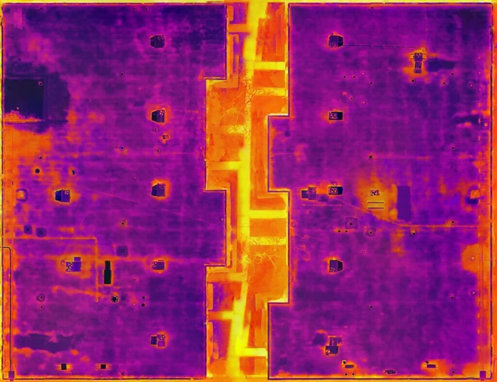


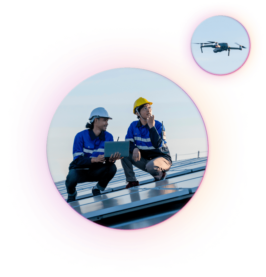
Roof inspection has changed with the use of drones. Traditionally, roof inspections of large commercial properties have taken days and required dangerous tasks such as climbing ladders, using harnesses and following strict health and safety procedures. But with the help of drones, the process has become much more efficient. Comprehensive and detailed reports can be generated thanks to advanced thermographic image processing.
We worked closely with our contractors and roofers to ensure they had a clear understanding of the tasks involved. A roof inspection can quickly and reliably identify water and weather damage, so you know exactly what your roof is doing. Plus, you can pinpoint exactly what issues need to be fixed.
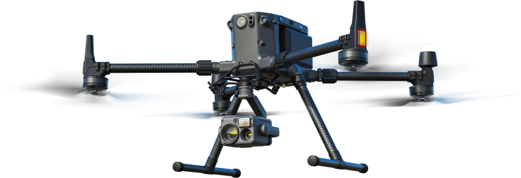
Our team consists of fully insured FAA-approved pilots. In addition, we have thermography certification, which guarantees our expertise in this field. Equally important, our team has a wealth of experience that enables us to quickly and efficiently identify your specific needs and provide you with the solutions you need without the complexity.
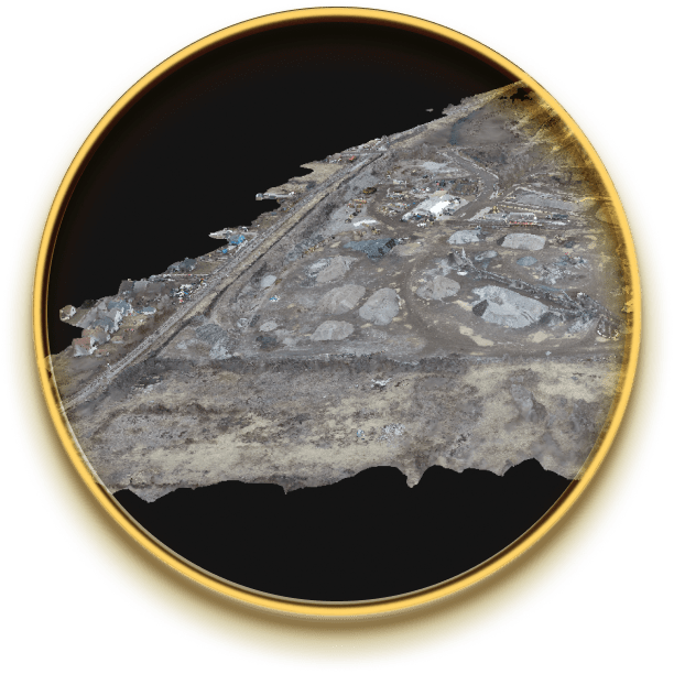
Aerial photography refers to the process of creating detailed maps or models of the earth's surface from above, usually using aerial photographs. Traditionally, airplanes or helicopters equipped with special cameras were used to capture images from an elevated perspective. However, with the development of drone technology, aerial surveying can now be effectively conducted using unmanned aerial vehicles (UAVs) or drones.
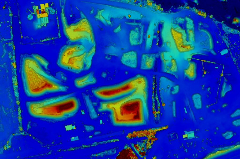
Photogrammetry, on the other hand, is the science and technology used to obtain measurements and accurate information about objects or surfaces from photographs. Photogrammetry plays a vital role in aerial mapping by drones. By taking overlapping aerial images from different angles and heights, drones can collect a comprehensive dataset of a target area.
These images are then processed using special software that analyzes visual information, identifies common points between images and reconstructs a three-dimensional representation of the landscape or objects. This process involves matching multiple image features to accurately determine their spatial location and orientation. The result is often a high-resolution model or point cloud - a collection of data points that represent the surface geometry of the mapped area.
Drones offer several advantages for aerial mapping and photogrammetry. They are cost effective, flexible and reach hard to reach places. Drones equipped with advanced cameras such as RGB or multispectral sensors can capture high-resolution images with accurate location information. This data is then used to produce accurate maps, assess topography, monitor changes over time, support infrastructure planning, aid in disaster management and more. The combination of drones and photogrammetry has revolutionized the field of aerial surveying, making it easier and more efficient than ever before.
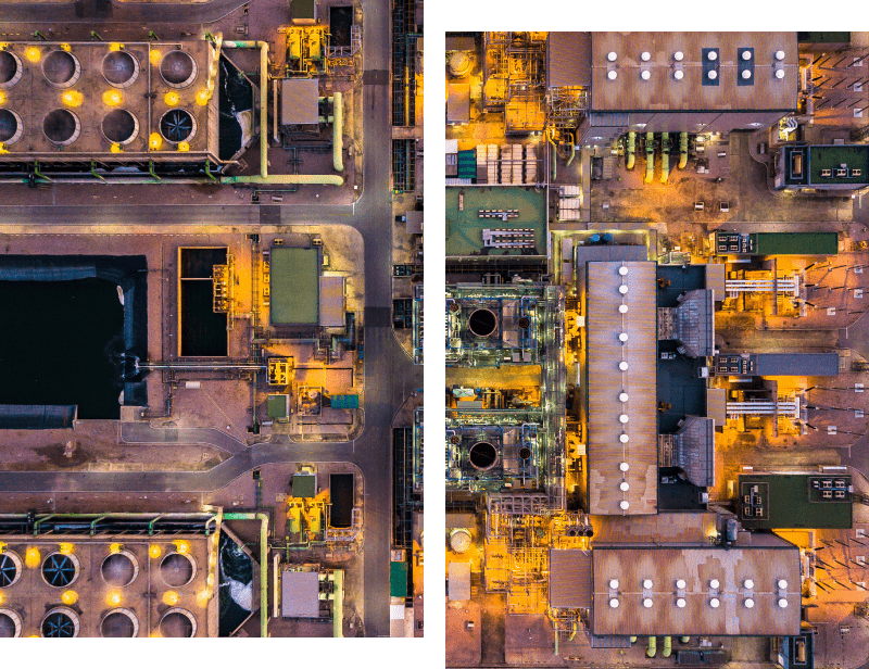
Now that Hollywood has recognized the amazing images that drones can capture, aerial photography has become a common sight in movies and TV shows. However, you don't need a Hollywood-sized budget to harness the power of aerial photography for your own purposes. At Midwest Radiometrix, we specialize in providing businesses with ultra-high resolution images and videos that provide a unique perspective.
Aerial photography is increasingly used in various situations due to its speed and efficiency. Whether it's a construction company documenting the progress of a construction project or a real estate company looking for awesome photos of their new locations, the demand continues to grow.
In aerial photography and videography, the skill of the pilot is as important as the quality of the drone itself. After all, having the best equipment is pointless if the person controlling it has no expertise. At Midwest Radiometrix, you can be sure because we work with highly experienced pilots who are outstanding in their field.

Drone inspection of wind turbines provides a safe and efficient way to assess the condition of wind turbines. Equipped with high-definition cameras and advanced sensors, drones can capture detailed images and collect data on turbine components such as rotor blades and towers. This technology minimizes the need for manual inspections and reduces downtime, enabling proactive maintenance and ensuring optimal performance of wind turbine systems.

Telecom tower inspection by drone revolutionizes tower evaluation, offering a safer and more cost-effective alternative to manual inspection. Equipped with high-definition cameras and sensors, drones capture accurate images and data that can be used to create a digital twin of the tower. These digital twins enable remote monitoring, analysis and planning, facilitate proactive maintenance, and improve overall tower performance and reliability.

Drones are increasingly being used to resolve insurance claims, simplifying the assessment process and speeding up claims. Equipped with high-resolution cameras and advanced imaging technology, drones can record detailed visual signs of property damage. In this way, insurers can remotely inspect and assess the extent of the damage, leading to faster and more accurate compensation solutions.

At our core, our passion for innovation drives us to push the boundaries of what drones can do. We keep abreast of the latest trends in the industry to provide our customers with the most advanced and efficient solutions available. Our team consists of qualified professionals with expertise in drone operations, data analysis and project management. We strive to provide accurate, reliable and actionable insights so that our clients can make informed decisions.
Customer satisfaction is our top priority and we strive to build strong and lasting relationships with every customer we serve. We take the time to understand our clients' unique needs and deliver services that exceed their expectations. Whether you're a construction company that needs detailed progress reports or an insurance company that needs a quick damage assessment, we can help you with our comprehensive drone services.
Experience the difference with a company that combines cutting-edge technology, industry expertise, and a customer-centric approach. Join us on this exciting flight and discover new perspectives and opportunities for your business.


Thermal inspection utilizes infrared technology to detect variations in temperature, allowing us to identify issues such as energy inefficiencies, electrical faults, or insulation problems. It helps you proactively address maintenance needs and improve overall efficiency.
Telecom tower digital twins are virtual replicas of physical towers created using data captured by drones. They enable remote monitoring, maintenance planning, and structural analysis, enhancing tower management efficiency while minimizing risks and costs.
Drone mapping facilitates accurate and detailed aerial surveys, providing real-time data on project progress, site conditions, and topographic features. It enables efficient project management, reduces manual labor, and assists in decision-making throughout the construction process.
Absolutely. Our drone pilots are licensed under FAA part 107 Remote Pilot and carry full insurance coverage. You can have peace of mind knowing that our operations meet all necessary legal requirements.
We utilize state-of-the-art drone technology equipped with high-resolution cameras, advanced sensors, and industry-specific tools. Our equipment ensures precise data capture and enables us to deliver accurate and reliable results.
We provide professional data analysis tailored to your specific needs. Our reports are comprehensive, actionable, and include visual representations, such as maps, imagery, and 3D models, to help you make informed decisions.
Absolutely. We have experience navigating the permitting process and can guide you through obtaining the required permissions for drone flights in compliance with local regulations and airspace restrictions.
Certainly, we would be happy to share references and showcase our portfolio of completed projects. We have successfully served clients in various industries, and we can provide you with relevant case studies that demonstrate our expertise.